While traveling the world, people have been amazed by various landforms and landscapes, some being lucky enough to experience them. However, do you know the different types of landforms and landscapes found around the world? Now, we will introduce them to you.
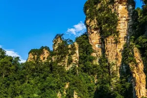
1. Danxia Landform
The Danxia landform is a type of landform that has steep slopes and is formed from red beds.
These red beds are mainly composed of continental facies and may include non-continental interlayers. This definition is widely accepted among scholars and can also be described as a "red bed landform with cliff slopes".
These red sandstones have been stripped by long-term weathering and eroded by flowing water, forming isolated peaks and steep strange rocks and rocks. The Danxia landform has developed along the vertical joints in the thick red sand and conglomerate layers, mainly in the horizontal or gently dipping red strata from the Jurassic to the Tertiary period.
2. Yardang Landform
Yardang landform is a special landform and a typical example of wind erosion. The professional term "Yadan" was formally introduced by Sven Hedin in 1903, and gradually accepted by geologists. It has been more than 100 years since the research began on this landform.
Yardang is a geological phenomenon formed by wind and sand erosion in arid regions. It is a unique landform characterized by continuous mounds and platforms that have been sculpted by nature's shaping power. These formations often resemble people, animals, and ancient castles, making them fascinating to observe.
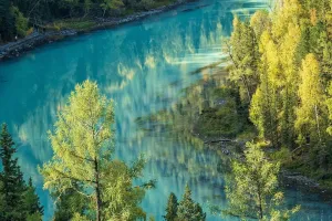
3. Glacial Landform
Glacial landform landscapes are mainly formed by the erosion and accumulation of glaciers. These landforms are characterized by special morphological features in high mountains and high latitudes, and are mainly distributed in the polar regions, and mountains and plateaus in the middle and low latitudes. Typical landscapes include "U"-shaped valleys, horn peaks, and ice cirques.
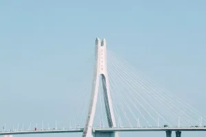
4. Coastal Landform
The general term for various landforms formed by the coast under the joint action of tectonic movement, seawater dynamics, biological action, and climatic factors.
The alternation of glacial and interglacial periods in the Quaternary period caused a large rise and fall of sea level and transgression and regression, resulting in continuous changes in the coast. From 6000 to 7000 years ago, the sea level rose to a height equivalent to the modern sea level, forming the basic outline of the modern coast and various coastal landforms.
5. Karst Landform
Karst landforms are created through the dissolution and precipitation of soluble rocks by groundwater and surface water, erosion and deposition, and gravity collapse and accumulation. These landforms are named after the karst plateau in Slovenia.
Karst typically refers to an area characterized by bare rocks, sparse vegetation, caves, sinkholes, underground rivers, and the lack of surface rivers and lakes. Karst landforms are the result of groundwater dissolving soluble massive limestone. The term karst was originally used to describe the limestone areas along the Dalmatian coast of the Adriatic Sea and is now used to refer to all similar areas. It is found in various parts of the world, such as the region of Kos in France and Kentucky in the United States.